Danger on a road rarely comes from one cause. Sometimes it is the drop beside the wheels, sometimes the weather overhead, and sometimes the simple fact that help is hours away. The seven roads below combine these hazards in different ways, from a cliffside tunnel carved largely by hand to a gravel haul route that runs north across the Arctic Circle. Each has earned its reputation honestly, and each rewards the traveler who prepares carefully.
Some of these roads have improved, and one is still waiting for a tunnel that should make it far safer. Others remain exactly as punishing as they were decades ago. Every entry below explains what makes the road hazardous, what travelers actually face on it, and what has changed recently, so you can weigh the risks yourself before you ever turn the key. Nothing here is a reason to stay home, only a reason to plan.
1. Yungas Road, Bolivia
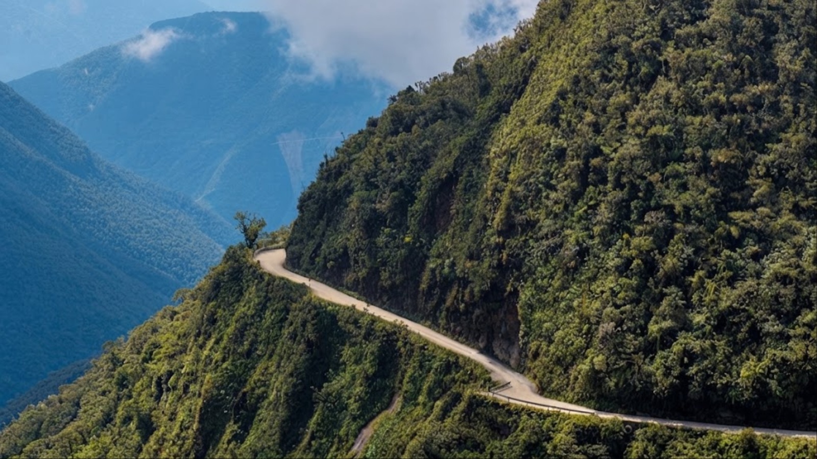
The North Yungas Road links La Paz with the town of Coroico, dropping from a cold, windswept pass of about 4,650 meters to subtropical forest at roughly 1,200 meters. That descent happens over some 64 kilometers, and for most of the twentieth century it happened on a dirt track barely wide enough for two vehicles to squeeze past each other. The track hugs a mountainside where the drop on the outer edge can reach several hundred meters, with no guardrail to speak of.
In 1995 the Inter-American Development Bank labeled it the most dangerous road in the world, and an estimate of 200 to 300 deaths a year has followed it ever since. Fog rolls in without warning, waterfalls spill across the surface, and rain turns the clay into a slick paste. Traffic travels on the left here, a deliberate rule that lets a driver on the outer edge look straight down and judge how close the wheels are to the void.
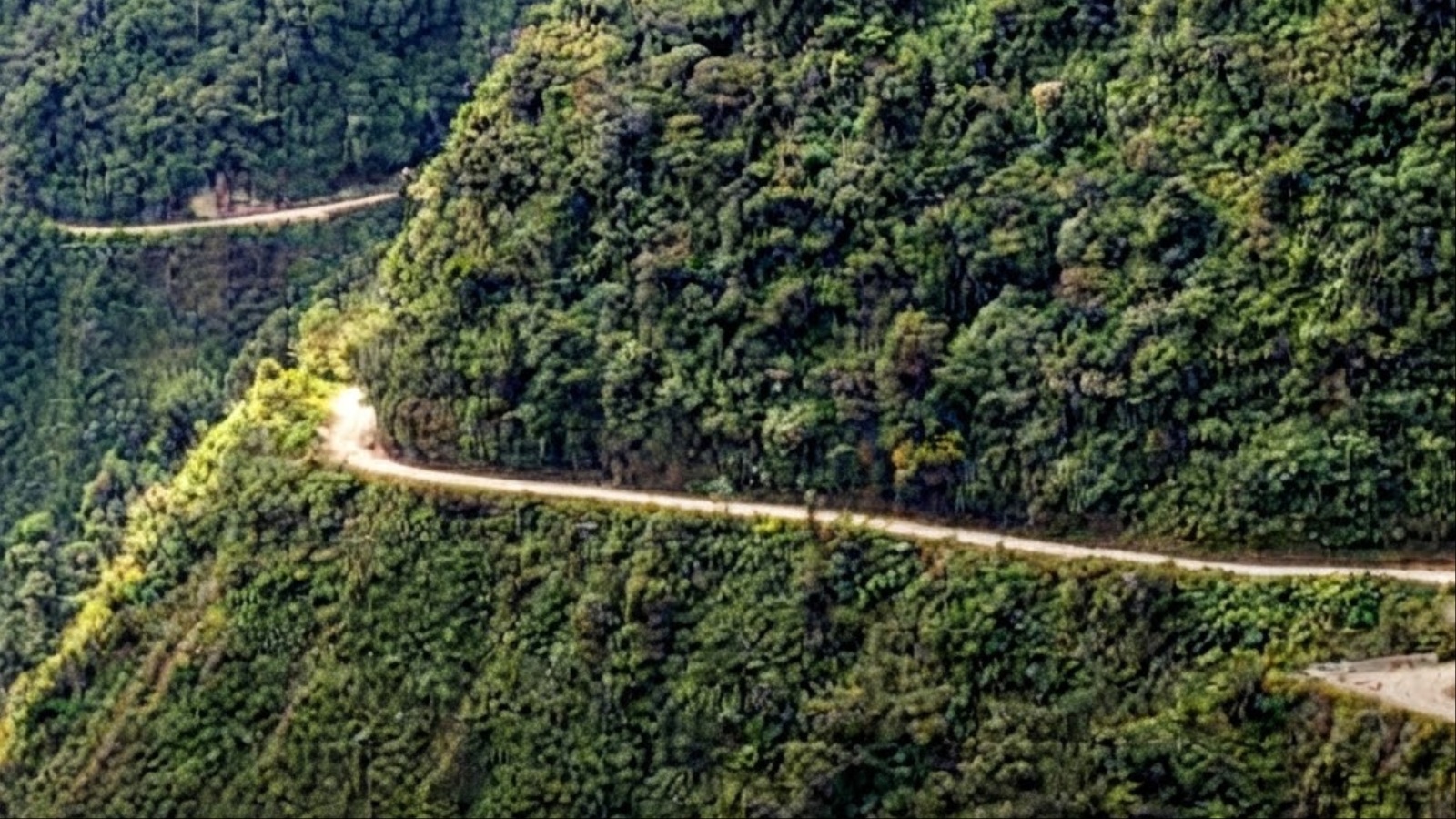
Everything changed in 2006, when a safer, paved bypass opened and drew most trucks and buses away. The old road, nicknamed El Camino de la Muerte, then found a second life as an adventure destination. Roughly 25,000 mountain bikers ride it each year, coasting downhill past crosses that mark earlier tragedies.
That second life has its own risks. Cyclists have died after misjudging a corner or losing control on loose gravel, and the road is still shared with the occasional local vehicle. Anyone planning to ride it should choose an operator with well-maintained brakes, proper safety gear and guides who know every bend. Drivers should treat the road as it was always meant to be treated, which is slowly, in daylight and with respect for the edge.
2. Guoliang Tunnel, China
Guoliang is a village in Henan Province perched on a cliff top in the Taihang Mountains, and for generations its residents lived in near isolation. Reaching the outside world meant climbing down a steep stone stairway cut into the rock, a journey that was exhausting in good weather and perilous in bad. Carrying goods, or getting help in an emergency, was a daily struggle.
In 1972 a group of thirteen villagers led by village head Shen Mingxin decided to build their own way out. With hammers, chisels and limited explosives, they began carving a tunnel along the face of the cliff. The work took roughly five years, and the tunnel opened in 1977. It runs about 1,200 meters, and the builders cut openings in the rock wall that serve as windows, letting in light and a stomach-turning view of the valley far below.
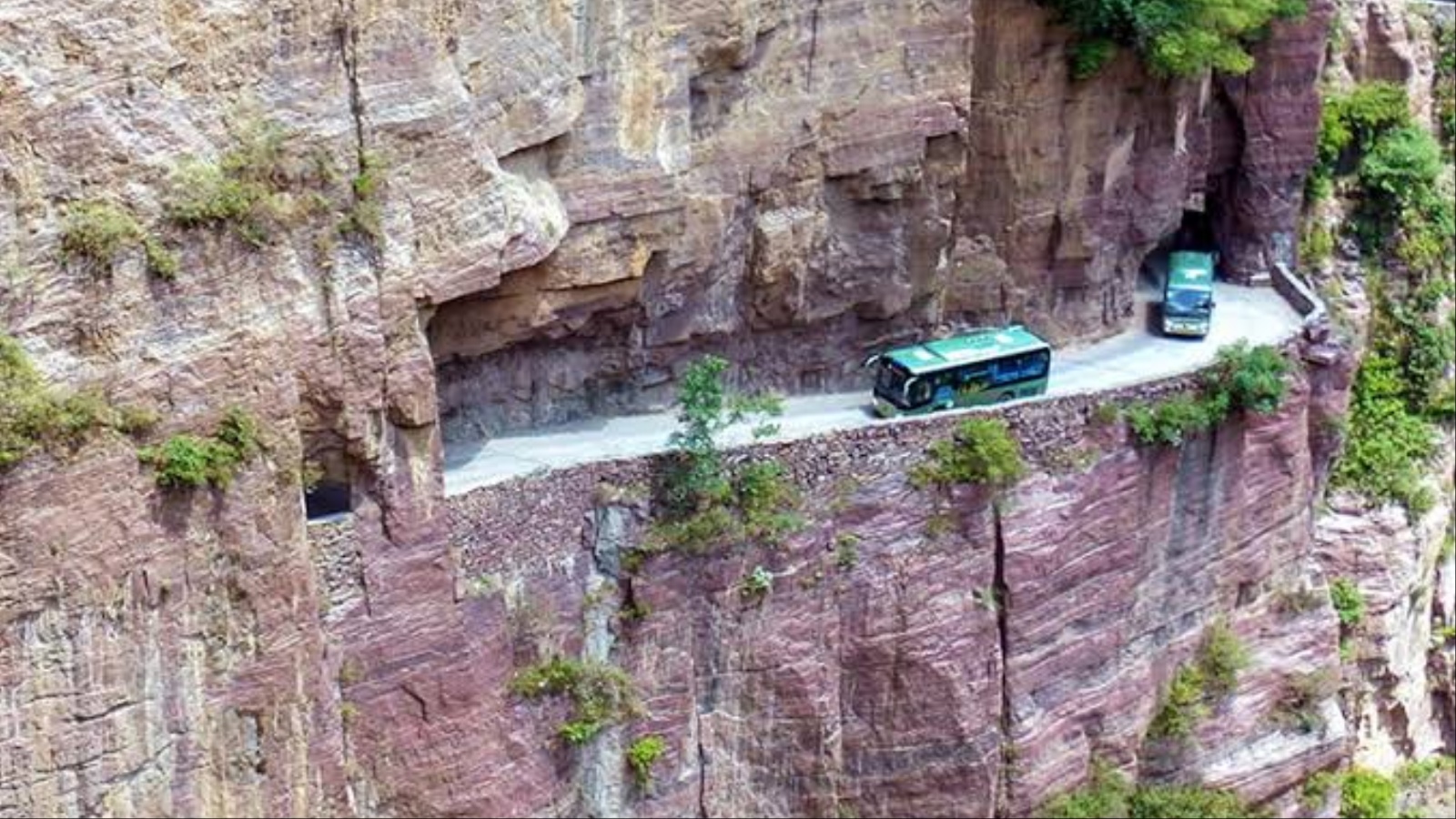
The danger today is different from the danger the builders faced. The passage is narrow and uneven, the walls are rough, and the lower side opens onto a sheer drop. Vehicles and pedestrians share the space, and drivers must negotiate blind curves while tour buses and cars try to pass each other in a gap that was never designed for modern traffic. A single misjudgment can mean scraping the rock or edging toward the open side.
The road has become a major tourist attraction, which is a fitting outcome for one of the most remarkable pieces of hand-built infrastructure anywhere. Visitors arrive to marvel at what a small community accomplished without machinery, then walk or ride through at a crawl. If you go, take it slowly, let local drivers lead, and spend a moment appreciating that every meter of it was shaped by human hands.
3. Zoji La, India
Zoji La is a high mountain pass at about 3,528 meters on the Srinagar–Leh highway, the road that links the Kashmir Valley with Ladakh. For the people of Ladakh and for the soldiers stationed along the border, it is a lifeline. For anyone driving it, it is a narrow, crumbling ribbon of road clinging to steep Himalayan slopes, with long drops on one side and loose rock on the other.
Winter is the main enemy. Heavy snowfall and avalanches regularly close the pass for months, cutting Ladakh off from the Kashmir side by road. Even when the pass is open, conditions can change within hours. Landslides, flash floods and sudden snow showers can block the route, and traffic is often restricted to one direction at a time under a strict schedule, with vehicles queued in long lines to wait their turn.
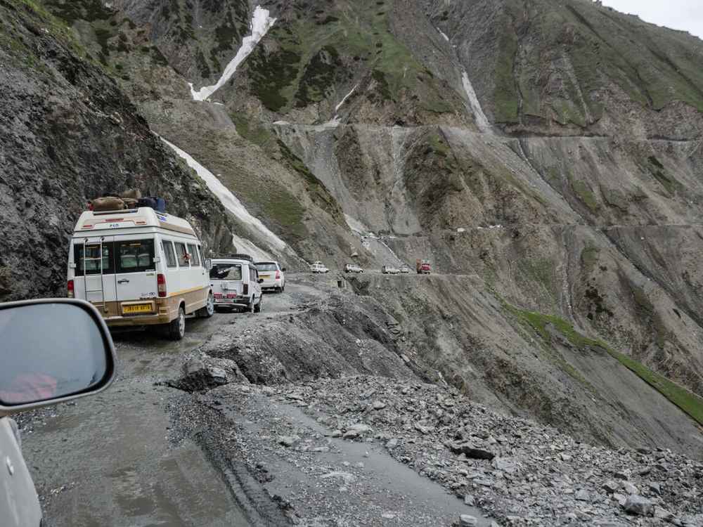
The road surface is a constant concern. Stretches are unpaved or broken, and meltwater runs across the carriageway in spring. Large trucks and army convoys share the same narrow lanes as tourist taxis and motorcycles, and passing on a blind bend with a drop beside you is a routine part of the journey. Thin air at altitude also affects engines and drivers alike.
A long-awaited fix is under construction. Digging for the Zojila Tunnel finished in June 2026, and the remaining fit-out work, covering paving, ventilation and electrics, is aimed at an opening in February 2028. Until it opens, the pass remains the only route. It is currently open but only during set hours, so confirm the road’s status the night before you leave. Carry warm clothing and supplies, and expect delays.
4. Skippers Road, New Zealand
Skippers Road winds into a remote canyon north of Queenstown on New Zealand’s South Island. It was built in the nineteenth century to serve gold miners working the Shotover River, and much of it was cut by hand into the sides of the canyon. The result is a road of about 22 kilometers that feels frozen in time, with sheer rock walls on one side and an unprotected drop on the other.
The road is mostly gravel, narrow and unfenced, with sections where two vehicles can barely pass. Corners are tight and often blind, and in places the surface runs beneath overhanging rock. Rain can loosen debris and cause slips, and the canyon floor is far enough below that a mistake leaves little room for recovery. Reaching help in a breakdown can take a long time because there is little traffic and patchy cell coverage.
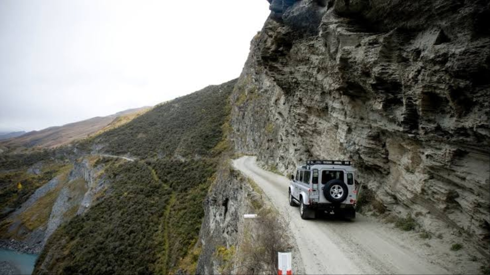
Rental car companies know all this, which is why most exclude the road from their agreements. A driver who takes a rental car there typically finds that insurance does not apply, leaving them personally liable for any damage or recovery costs. That single fact is the clearest signal of how seriously the road is regarded by people who assess risk for a living.
Anyone determined to see the canyon has safer options. Local operators run guided trips along the road with vehicles and drivers experienced on its quirks, and some tours add a ride over the historic suspension bridge and a look at the old mining relics scattered along the way. The scenery is spectacular and the history is rich, but this is a road best seen with someone who has driven it many times before.
5. Karakoram Highway, Pakistan and China
The Karakoram Highway runs about 1,300 kilometers from Hasan Abdal, near Islamabad, to Kashgar in China’s Xinjiang region. It threads through three great mountain ranges, the Karakoram, the Himalaya and the Hindu Kush, and crosses the Khunjerab Pass at about 4,700 meters, among the highest paved border crossings anywhere. The scenery is staggering. So are the hazards.
Construction took roughly two decades, finishing around 1979, and the cost in human lives was severe, with hundreds of workers killed by rockfalls, landslides and accidents. The mountains that made the road so hard to build have never stopped threatening it. The geology is young and unstable, and the highway sits on slopes prone to rockfall, landslides and washouts, especially during the summer monsoon and spring melt.
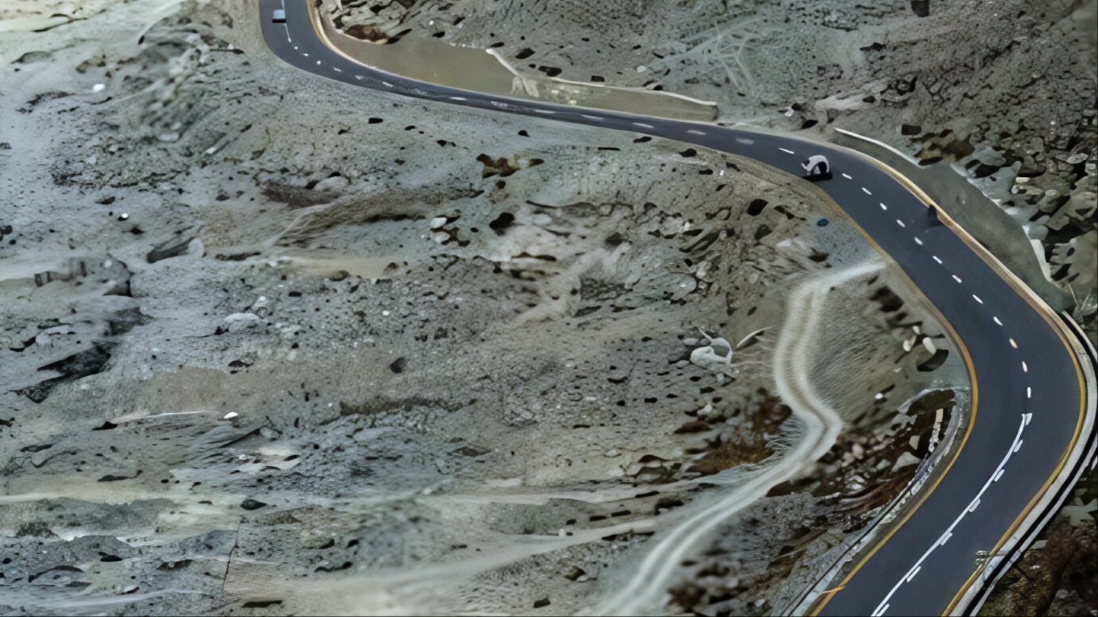
The most dramatic example came in 2010, when a massive landslide in the Hunza Valley dammed the river and created Attabad Lake, drowning a stretch of the highway and the villages beside it. A series of tunnels, built with Chinese funding, eventually carried traffic over the lake and reopened the route in 2015. Floods in later years have damaged other sections again.
Driving here means contending with narrow lanes, steep drops, heavy trucks and sudden road closures. Altitude affects both vehicles and travelers, and in winter snow closes the high sections, including the border crossing, for months. Travelers should check security and road advisories, avoid driving at night, allow generous buffers for delays, and plan for a route that may change from one day to the next.
6. Fairy Meadows Road, Pakistan
The road to Fairy Meadows is not a highway but a jeep track, and it is one of the most nerve-racking short drives in the world. It begins at Raikot Bridge on the Karakoram Highway and climbs steeply to the village of Tato, a journey of around sixteen kilometers. From there, visitors continue on foot for several hours to reach a high alpine meadow beneath the vast mass of Nanga Parbat.
The track is a single lane cut into a cliff face, with a drop of hundreds of meters on one side and rock wall on the other. It is rough, rocky and often rutted, and it has no barriers of any kind. Sections cross loose slopes where landslides are common, particularly during the monsoon. When two vehicles meet, one must reverse to a place wide enough to pass, usually with the outer wheels hovering near the edge.
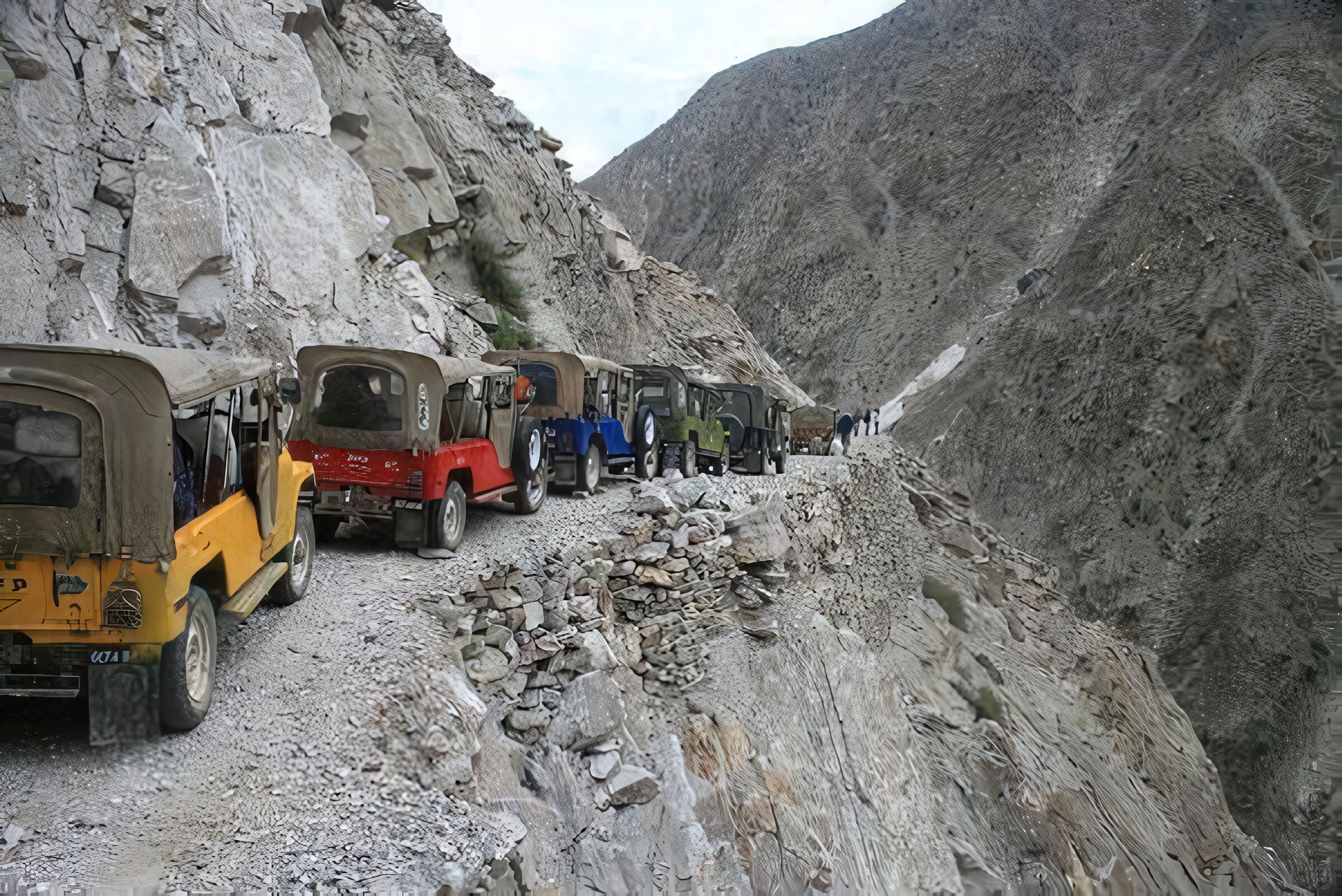
Private cars are not an option for most visitors. Local drivers, who know every bend and rut, operate the jeeps that carry travelers, and that local knowledge is the main safety measure the route has. Even so, the ride is slow, bumpy and unnerving, and passengers often find themselves leaning toward the cliff wall as the jeep crawls around exposed corners.
The reward is worth the effort for many. Fairy Meadows sits around 3,300 meters, with meadows, pine forests and a view of Nanga Parbat that ranks among the finest in the Himalaya. The season is short, typically late spring through early autumn, because snow closes the area for much of the year. Visitors should check weather and access conditions in advance and travel in daylight only.
7. Dalton Highway, Alaska, USA
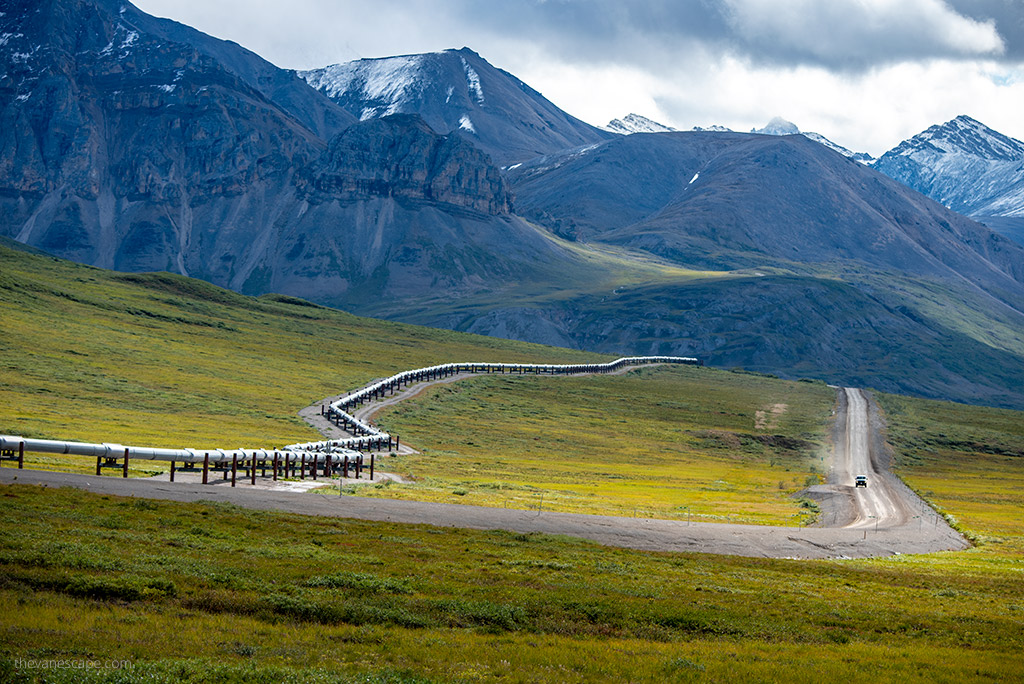
The Dalton Highway, officially Alaska Route 11, runs about 666 kilometers (414 miles) from near Livengood to Deadhorse on the shore of the Arctic Ocean. It was built in 1974 as a haul road to support construction of the Trans-Alaska Pipeline, and it still serves heavy trucks carrying supplies to the oil fields of the North Slope. It crosses the Arctic Circle and the Brooks Range and passes through some of the emptiest country in North America.
The danger here comes from isolation as much as from the road itself. Long sections are gravel, and the surface can swing from hard-packed to slick with mud within a single storm. Heavy trucks raise clouds of dust and throw rocks that crack windshields, and they do not yield easily, so drivers are advised to pull over and give them room. Services are sparse, with fuel and food available only at a few widely spaced points.
Weather is the other major threat. Winter temperatures can plunge far below freezing, and even in summer a rain or snow shower can appear without warning. Atigun Pass, which climbs through the Brooks Range to about 1,440 meters, features steep grades and fierce winds. A breakdown in this country can mean a long wait in the cold, because cell service is nonexistent for most of the route and traffic can be thin.
Preparation matters more than skill. Carry at least two spare tires, extra fuel, food, water, warm layers and a satellite communication device, and check conditions before setting out. Many rental companies prohibit use of their vehicles on the highway, so confirm the rules before you book.