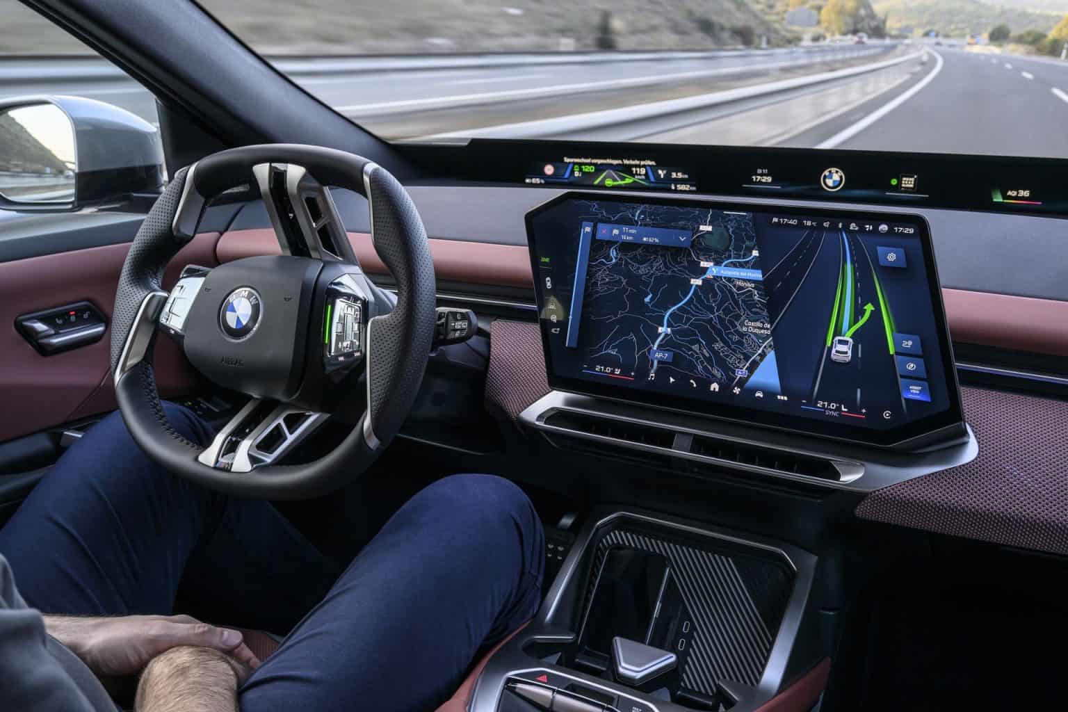
BMW is preparing to bring navigation and driver-assistance information together in a single three-dimensional display, giving drivers a clearer picture of where they need to go and how their vehicle is responding to the road.
Announced on October 20, 2026, BMW Maps with Driver Assistance is scheduled to begin rolling out in November for vehicles equipped with BMW Operating System X in eligible markets.
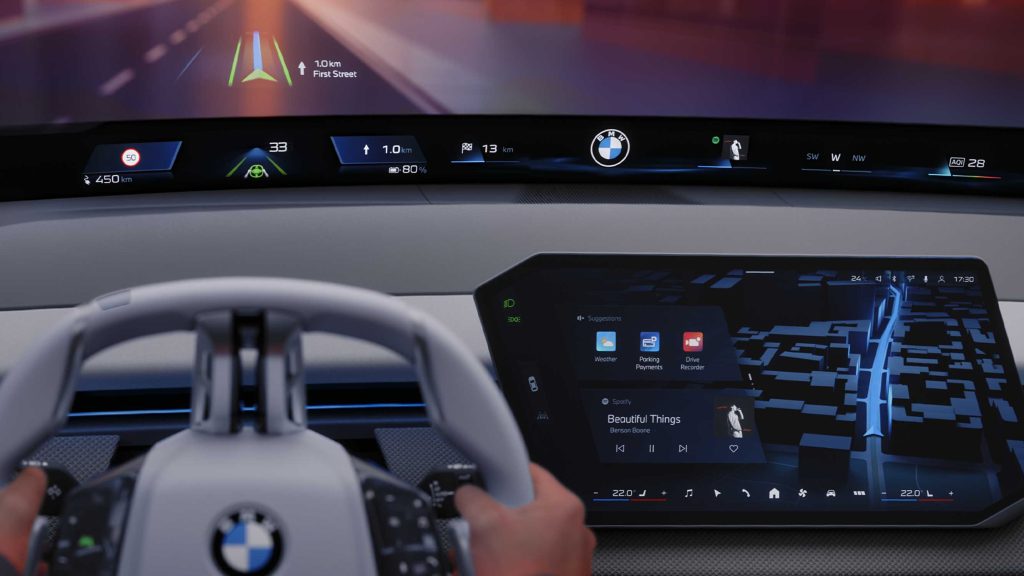
The new interface combines route guidance, the vehicle’s surroundings, and information about active assistance functions on the central display. Instead of checking separate screens to understand a navigation instruction and the car’s response, drivers can view these details together.
The aim is to make complex driving situations easier to understand, particularly on multilane highways, at busy intersections and around complicated road junctions.
BMW Combines Route Guidance and Surroundings in One 3D Display
Traditional vehicle navigation systems focus primarily on directions, showing a route, an upcoming turn, and an estimated arrival time. Driver-assistance systems, meanwhile, may display detected vehicles, lane markings, and active functions elsewhere in the cockpit. BMW’s new system brings these sources of information into one integrated view.
BMW Maps with Driver Assistance displays the vehicle in its detected lane and at the appropriate level of a road. That distinction matters at interchanges, where roads cross at different heights, and at junctions where drivers must choose among several lanes.
The display also represents surrounding traffic and indicates which assistance functions are active.
For example, a driver approaching a highway exit may need to follow navigation instructions while understanding whether the car’s assistance system is controlling speed and steering. By presenting the route and assistance status together, BMW aims to make the relationship between the planned maneuver and the vehicle’s actions easier to follow.
The feature has been developed by BMW using navigation data and mapping technology from Mapbox. BMW integrates those resources with information from the vehicle’s sensors and its driver-assistance systems to create the combined visualization.
The goal is not simply to make the map more attractive but to show how the car interprets the road and where it sits within the driving environment.
This approach reflects a broader change in vehicle interface design. As cars gain more sophisticated assistance functions, drivers need to understand not just what a system is doing, but how it relates to the next turn, lane change, or exit.
A clear visual connection between navigation and assistance may reduce the need to interpret separate pieces of information.
The central display remains the primary location for this combined view. BMW has not announced that the new feature replaces every other driver-information display, nor does the announcement suggest that drivers can stop monitoring the road. It is a new way to organize information, rather than a substitute for attentive driving.
Availability is also conditional. BMW says the feature requires Operating System X and compatible driver-assistance equipment, such as Highway Assistant or Highway & City Assistant. It will be offered only in selected countries, cities, and road environments, with availability expanding in phases. Not every BMW with a navigation screen will receive it.
Highway Assistant Shows Why the Integration Matters
One of the clearest applications is BMW Highway Assistant, which supports hands-free driving on eligible highways when the driver-assistance system is available and engaged. BMW says the system can control speed and steering at speeds of up to 85 mph in the United States.
It also supports automated lane changes after the driver confirms the maneuver with a glance.
With navigation active, the system can support the journey from a highway entrance to an exit. Bringing route guidance and assistance information together can help drivers understand where the vehicle is positioned, which lane it occupies, and how the active assistance function relates to the route.
That is particularly relevant when a route requires several decisions in quick succession. A driver may need to anticipate an exit, account for traffic, and understand a lane change while traveling at highway speed. A unified display can make the connection between these tasks more visible than separate navigation and assistance screens.
However, hands-free capability does not mean the vehicle is fully autonomous. The system operates within defined conditions and geographical limits, and the driver must remain attentive and comply with its requirements. BMW’s announcement describes assistance technology, not a system that removes the human driver’s responsibility.
The display may also help drivers understand when assistance is active and what the vehicle is detecting. That transparency is increasingly important as manufacturers introduce more advanced systems.
A driver who can see how the vehicle is positioned relative to lanes and surrounding traffic may find the assistance easier to interpret, although the actual safety benefit will depend on the system’s accuracy and how clearly the information is presented.
BMW’s longer-term plans extend beyond highway driving. The company has discussed navigation-guided, partly automated urban driving for vehicles equipped with Operating System X, with an initial rollout planned in Germany in 2027.
City driving presents additional challenges, including traffic lights, roundabouts, turning lanes, and interactions with pedestrians and cyclists.
The planned urban capability is separate from the November navigation-display rollout. The 3D interface helps bring navigation and assistance information together, but its introduction does not mean that every equipped vehicle will immediately gain automated city-driving functions.
Those capabilities depend on compatible hardware, software, regulatory approval, and where the vehicle is operating.
A Wider Shift Toward More Understandable Vehicle Interfaces
BMW’s announcement highlights an industry-wide challenge for automakers, which is integrating new technology while keeping the driving experience simple and user-friendly.
Modern vehicles can present navigation, speed, driver alerts, charging information, traffic detection, and assistance status across multiple displays. Without careful design, more information can mean more distraction rather than greater clarity.
Combining related information into a single view is one way to address that problem. Drivers following a route can see the car’s position in the lane while also understanding which assistance feature is supporting the journey. In complex traffic, that relationship may be more useful than a map that shows directions alone.
The quality of the interface matters as much as the amount of information displayed. A three-dimensional representation must remain legible at a glance, distinguish important road features, and avoid overwhelming the driver with unnecessary graphics. Automakers must balance visual detail with the need to keep attention on the real road.
There is also a difference between displaying what a vehicle detects and guaranteeing that its perception is complete. Sensors and software have operating limitations, and road conditions can change quickly.
Drivers must continue to use their own judgment and follow the vehicle’s instructions rather than treating the digital view as an infallible representation of the surroundings.
BMW has not announced a separate price for BMW Maps with Driver Assistance in the United States. Its availability depends on the vehicle’s Operating System X platform, compatible assistance equipment, and the relevant market.
The November 2026 rollout is the announced starting point, with availability expanding in stages rather than appearing across the entire BMW range at once.
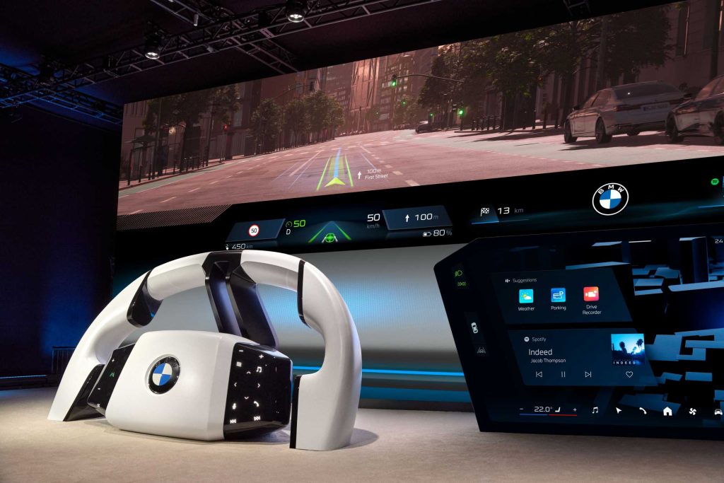
The system’s success will ultimately depend on how useful it proves in real driving. Drivers need to recognize lane guidance, understand the vehicle’s behavior, and interpret assistance status without spending excessive time looking at the screen.
Clearer integration could make advanced assistance easier to use, but real-world usability and driver attention remain essential.
BMW Maps with Driver Assistance is therefore more than a navigation update. It reflects the industry’s move toward interfaces that explain how a vehicle’s route, surroundings, and automated assistance work together.
By connecting these elements in one 3D display, BMW hopes to make increasingly sophisticated driving technology easier to understand, while leaving drivers responsible for staying alert and in control.