Before GPS became a standard feature in cars, smartphones, ships, and aircraft, people relied on clever tools, scientific observations, and carefully developed techniques to find their way. From ancient sailors reading the stars to drivers following printed road maps, navigation has a long history shaped by human curiosity and practical necessity.
These earlier systems helped travelers cross oceans, explore unfamiliar territories, transport goods, and connect distant communities. Understanding seven navigation systems from before GPS reveals how people solved direction and distance problems using the knowledge and technology available to them throughout different periods of history.
1. Celestial Navigation – Finding Directions Through the Stars
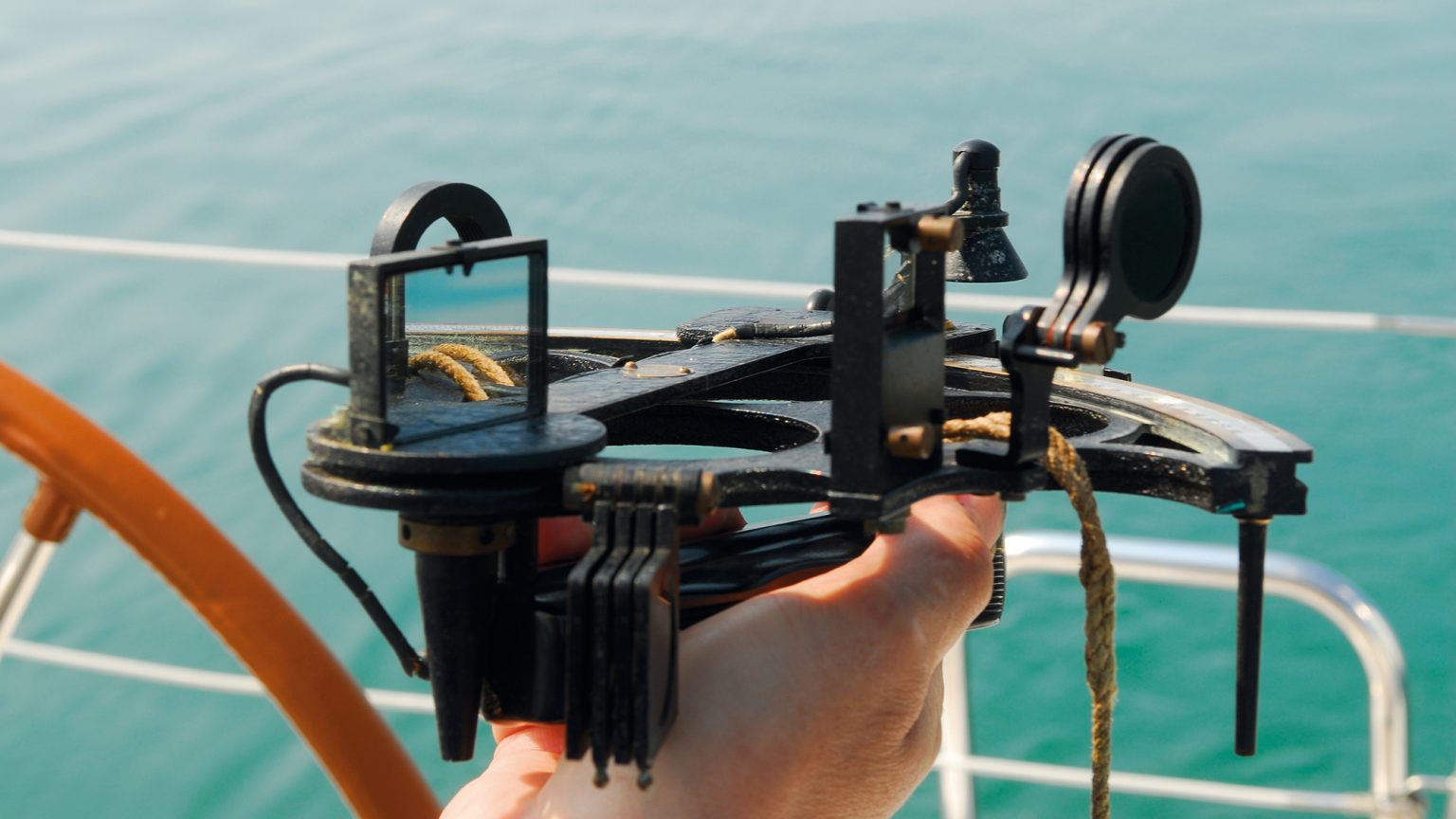
Celestial navigation is among the oldest methods used to determine position and direction during long journeys. Travelers observed the Sun, Moon, stars, and planets to understand where they were and which direction they needed to follow. Ancient sailors depended heavily on these observations because open seas offered few visible landmarks.
By recognizing familiar star patterns and tracking their movement across the sky, navigators could maintain a reasonably consistent course. This knowledge developed gradually through repeated voyages, careful observation, and information passed between generations of sailors, merchants, and explorers.
The North Star, also called Polaris, became particularly useful for navigation in the Northern Hemisphere. It appears close to the north celestial pole, making it a reliable reference point for identifying north. Its height above the horizon also provides an approximate indication of latitude.
For example, someone observing Polaris from a location farther north would generally see it higher in the sky than someone observing it closer to the equator. Sailors learned to combine this observation with other signs, including prevailing winds, ocean currents, and the appearance of the coastline, to improve their understanding of their position.
The Sun provided another important reference for determining direction. In many regions, travelers observed its apparent movement from east to west to establish a general sense of orientation. More advanced navigators used instruments and mathematical tables to measure the Sun’s altitude at particular times.
With an accurate time reference and appropriate calculations, they could estimate their latitude. Determining longitude was much harder because it required comparing local time with the time at a known reference location. Reliable marine chronometers eventually made this calculation far more practical, particularly during the eighteenth century.
Celestial navigation became increasingly sophisticated as astronomical knowledge improved. Arab, Indian, Greek, Chinese, and European scholars contributed to the mathematical and observational traditions that supported navigation. Their methods were adapted to local environments, trade routes, and available instruments.
Sailors learned to recognize seasonal star patterns and understand how celestial bodies appeared at different latitudes. This knowledge was especially valuable during long ocean crossings, where even small errors in direction could result in substantial detours.
Written tables, navigational manuals, and teaching traditions helped preserve techniques that had previously depended heavily on experience.
Even after modern electronic navigation became available, celestial navigation retained practical value. Naval personnel, offshore sailors, and maritime training institutions continued teaching astronomical methods because they offered a way to determine position without relying on satellite signals.
The technique required clear enough skies, accurate observations, suitable instruments, and mathematical skill. It was not always easy to use in cloudy weather or rough seas, yet it provided an independent source of navigational information.
Its history demonstrates how observing natural patterns could support complex journeys long before electronic positioning systems existed.
2. Magnetic Compass Navigation – Using Earth’s Magnetic Field
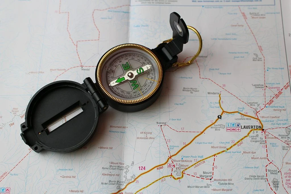
The magnetic compass changed navigation by providing a relatively dependable indication of direction without requiring clear skies or visible landmarks. Its operation depends on a magnetized needle that aligns approximately with Earth’s magnetic field.
Early magnetic compasses were developed in China, where magnetic properties were known long before the instrument became widely established in maritime navigation.
Over time, compass technology spread through trade and cultural exchange, helping travelers maintain their direction on land and at sea. The instrument proved particularly useful when fog, darkness, or unfamiliar surroundings made visual orientation difficult.
Early compasses took several forms. Some used a magnetized needle floating on water, while later designs placed a needle on a pivot so it could rotate freely. Maritime compasses gradually developed into more practical instruments designed for use aboard moving vessels.
Their marked compass cards indicated directions such as north, east, south, and west, with additional divisions supporting more precise steering.
As construction improved, sailors gained a consistent reference that could be checked throughout a journey. This did not reveal their exact location, but it helped them follow a planned heading.
Using a compass required an understanding of magnetic variation, also known as magnetic declination. Magnetic north does not always match geographic north, and the difference varies by location and changes over time. Navigators who ignored this distinction could gradually drift away from their intended route.
Shipboard iron, nearby magnetic materials, and the vessel’s own structure could also affect compass readings. Experienced navigators therefore compared compass directions with charts, astronomical observations, and known landmarks whenever possible. These precautions improved reliability and helped distinguish an instrument error from an actual change in course.
On land, compasses supported surveying, military movement, wilderness travel, and the preparation of maps. Surveyors used them to establish bearings between points, while travelers could follow a route through forests or mountainous terrain without needing a continuous view of the Sun.
A compass became especially useful when combined with a map, since the map showed the surrounding geography and the instrument indicated the direction of travel. This combination helped users move between known locations, estimate route changes, and recover their bearings when the landscape looked unfamiliar.
The magnetic compass remains useful today, particularly in hiking, boating, surveying, and emergency preparedness. Its major advantage is independence from batteries, mobile networks, and satellite reception.
However, it cannot provide an exact position by itself, and accurate use requires attention to map alignment, magnetic declination, and nearby sources of interference.
Before GPS, compass navigation formed a central part of many professional and recreational navigation systems. Its lasting importance comes from its simplicity, portability, and ability to provide directional information under conditions that challenged other methods.
3. Paper Maps and Road Atlases – Planning Routes by Hand
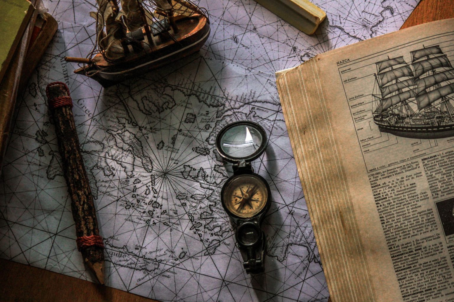
Paper maps served as essential navigation tools for travelers, merchants, surveyors, military forces, and motorists long before digital mapping became commonplace. A map presents geographic information in a compact visual format, allowing users to understand roads, rivers, settlements, terrain, and boundaries.
Printed maps developed through centuries of surveying and cartographic work, with improvements in measurement and printing making them increasingly useful.
By the nineteenth and twentieth centuries, detailed road maps and atlases had become important resources for people traveling between towns, crossing regions, or planning journeys across entire countries.
Road atlases became especially popular as automobile ownership increased during the twentieth century. Drivers could consult a regional or national atlas to identify highways, junctions, towns, and alternative routes. Many maps included road classifications, mileage tables, indexes, and symbols indicating useful facilities.
Before leaving home, motorists often traced their intended route with a pencil and noted the towns they expected to pass. During the journey, they checked road signs against the printed information and adjusted their plans when construction, closures, or unexpected detours interrupted their progress.
Reading a paper map required more than recognizing place names. Users needed to understand scale, symbols, orientation, and the relationship between mapped distance and real distance. A scale might indicate that a certain measurement on paper represented several kilometers on the ground.
Contour lines on topographic maps communicated elevation changes, helping hikers and surveyors understand the shape of the landscape. Grid references and coordinate systems allowed users to identify particular locations more precisely. These skills helped transform a printed sheet into a practical navigation instrument rather than simply a picture of a region.
Map quality depended on the accuracy and age of the underlying information. New roads, changing administrative boundaries, expanding suburbs, and altered transport networks could make older editions unreliable. Travelers therefore benefited from checking publication dates and carrying updated maps when possible.
Even current maps sometimes lacked small access roads or temporary diversions, making local road signs and direct observation important. Skilled travelers rarely treated the printed route as unquestionable. They used it as a guide, compared it with the landscape, and made sensible decisions when actual conditions differed from what the map showed.
Paper maps continue to offer advantages that digital navigation cannot completely replace. They provide a broad view of an entire region, work without electrical power, and encourage users to understand the geography surrounding their destination.
A driver studying a full road atlas may notice alternative routes that are not immediately obvious on a small phone display. Hikers can use topographic maps to assess terrain and plan escape routes.
Although digital tools have reduced the need to carry printed maps every day, the principles of map reading remain valuable for independent travel, emergency planning, and geographical education.
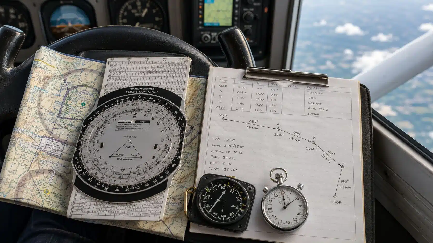
4. Dead Reckoning – Calculating Position Through Movement
Dead reckoning is a navigation technique that estimates a person’s current position by starting from a known location and calculating subsequent movement. The navigator records the direction traveled, the distance covered, and the time spent moving. These observations are used to estimate where the traveler should be.
The method has a long history in maritime navigation and has also been applied to aircraft, military operations, and land travel. Its central advantage is that it can continue to provide estimates when external landmarks or reliable position references are unavailable.
For a simple example, imagine a ship leaving a harbor and sailing east for a known distance. If the crew knows the departure position, the heading, and the approximate distance traveled, it can plot an estimated new position on a chart.
After changing direction, the navigator adds the next movement to the previous calculation. Repeating this process creates a series of estimated positions along the journey. Traditionally, navigators plotted these movements on paper charts using a pencil, dividers, and instruments for measuring angles and distances.
Accuracy depends on how well the navigator measures speed, heading, and elapsed time. Small errors accumulate as the journey continues, particularly when the vessel encounters changing winds, currents, or waves.
A ship may point east while moving slightly north or south because the water carries it away from its intended course. Aircraft can experience similar differences between heading and actual movement over the ground because of wind.
If the navigator fails to account for these effects, the estimated position may gradually separate from the real one.
To improve dead reckoning, navigators combined it with other available sources of information. Sailors compared calculated positions with observations of the Sun, stars, coastal landmarks, or known depths of water. Aircraft crews could use radio navigation aids or visual references when conditions permitted.
Each new observation helped reduce uncertainty in the estimated location. This demonstrates a key principle of navigation, as calculations become more reliable when they are verified using independent evidence rather than relying on the same underlying assumptions.
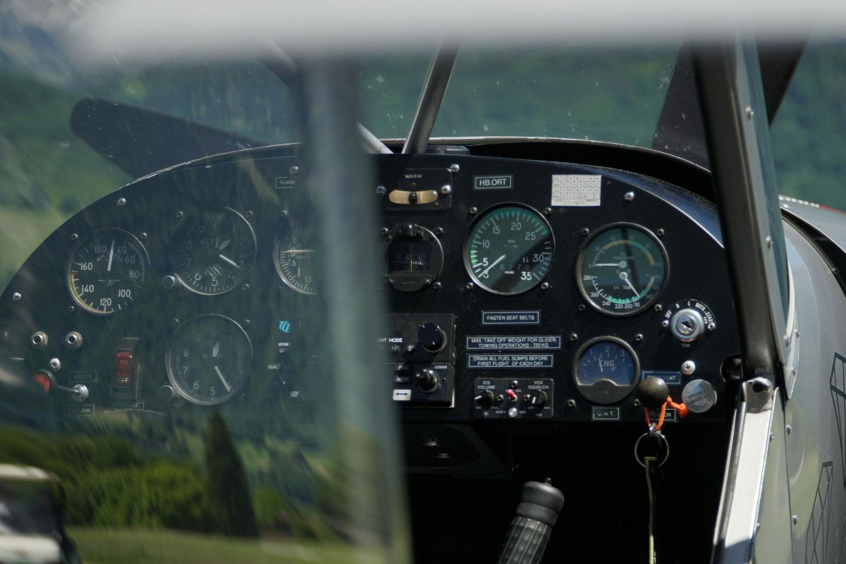
5. Radio Navigation – Finding Position Through Radio Signals
Radio navigation introduced a major change in how ships and aircraft determined their positions. Instead of depending entirely on visual landmarks or observations of the sky, navigators could use radio signals transmitted from known locations. These signals provided information that helped crews estimate direction, distance, or position.
Radio-based systems developed during the early twentieth century and became increasingly important as aviation expanded and commercial shipping grew more complex. They were especially valuable during darkness, poor visibility, and long journeys across areas where recognizable landmarks were scarce.
Early radio direction-finding equipment allowed operators to determine the direction from which a radio signal arrived. A ship or aircraft could receive transmissions from a known station and use a directional antenna or other equipment to establish a bearing.
When bearings from multiple stations were available, navigators could estimate their location by plotting the intersecting lines on a chart. This technique became useful for maritime operations, military missions, and aviation. Its accuracy depended on the equipment, signal conditions, station locations, and the skill of the operator interpreting the readings.
Radio navigation later developed into more specialized systems, including radio beacons and ground-based aviation navigation aids. Non-directional beacons transmitted signals that aircraft could receive using an automatic direction finder.
The instrument indicated the direction toward the beacon, allowing pilots to follow a bearing or determine their position in relation to the station.
Very High Frequency Omnidirectional Range, commonly called VOR, provided more precise directional guidance for aircraft. Pilots used VOR stations to follow established airways and identify their position relative to specific navigation points.
Long-range radio navigation systems became particularly important for aircraft flying beyond the range of visual references. LORAN, short for Long Range Navigation, used the timing differences between radio signals from synchronized transmitting stations to help determine a receiver’s position.
The system was widely used for maritime navigation and had applications in aviation. LORAN-C, in particular, provided useful coverage over large areas and supported many ships and other users before satellite positioning became widespread. Its operation required specialized receiving equipment and suitable signal coverage, so availability varied by region.
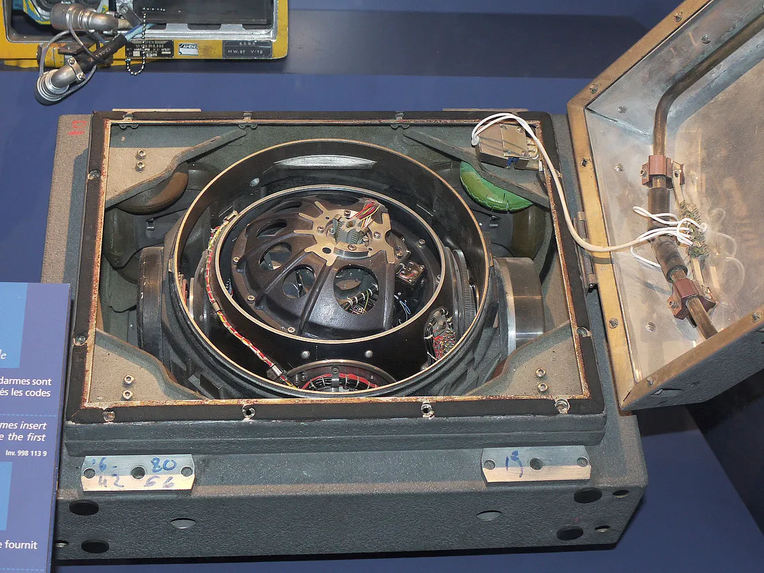
6. Inertial Navigation Systems – Tracking Movement Without External Signals
Inertial navigation systems estimate position by measuring how an object moves from a known starting point. These systems use instruments such as accelerometers and gyroscopes to measure acceleration and orientation changes. A computer processes the measurements to calculate changes in velocity and position.
Unlike systems that depend on radio transmitters, visible landmarks, or satellite signals, inertial navigation can operate independently once it has been initialized. Its development became particularly important during the twentieth century, when aircraft, submarines, spacecraft, and military vehicles required reliable navigation in environments with limited external references.
The basic principle involves tracking motion over time. Accelerometers measure acceleration along particular axes, while gyroscopes help establish the direction in which those measurements occur. By integrating acceleration measurements, the system estimates changes in velocity and then calculates changes in position.
Before a journey begins, the equipment must establish an initial position and orientation. As the vehicle moves, the system continually updates its estimated location. The calculations are complex, and even small measurement errors can influence the final result.
Inertial navigation became especially valuable for aircraft operating over oceans and submarines traveling underwater. Aircraft could fly long distances without needing a continuous radio connection to ground-based stations. Submarines could navigate beneath the surface, where satellite signals cannot be received directly.
In military applications, inertial systems also provided guidance for vehicles that needed to function without depending on external radio transmissions. These capabilities made inertial navigation particularly useful in situations where signal availability, security, or environmental conditions limited other navigation methods.
The accuracy of an inertial system depends on the quality of its sensors, the stability of its calculations, and the length of time it operates without correction. Measurement errors accumulate, causing the estimated position to drift away from the actual location.
High-quality systems reduce this problem through improved instruments, careful calibration, and sophisticated mathematical processing.
Many modern installations also combine inertial measurements with satellite positioning or other navigation references. When an external signal becomes available, the system can compare its estimate with that reference and correct accumulated errors.
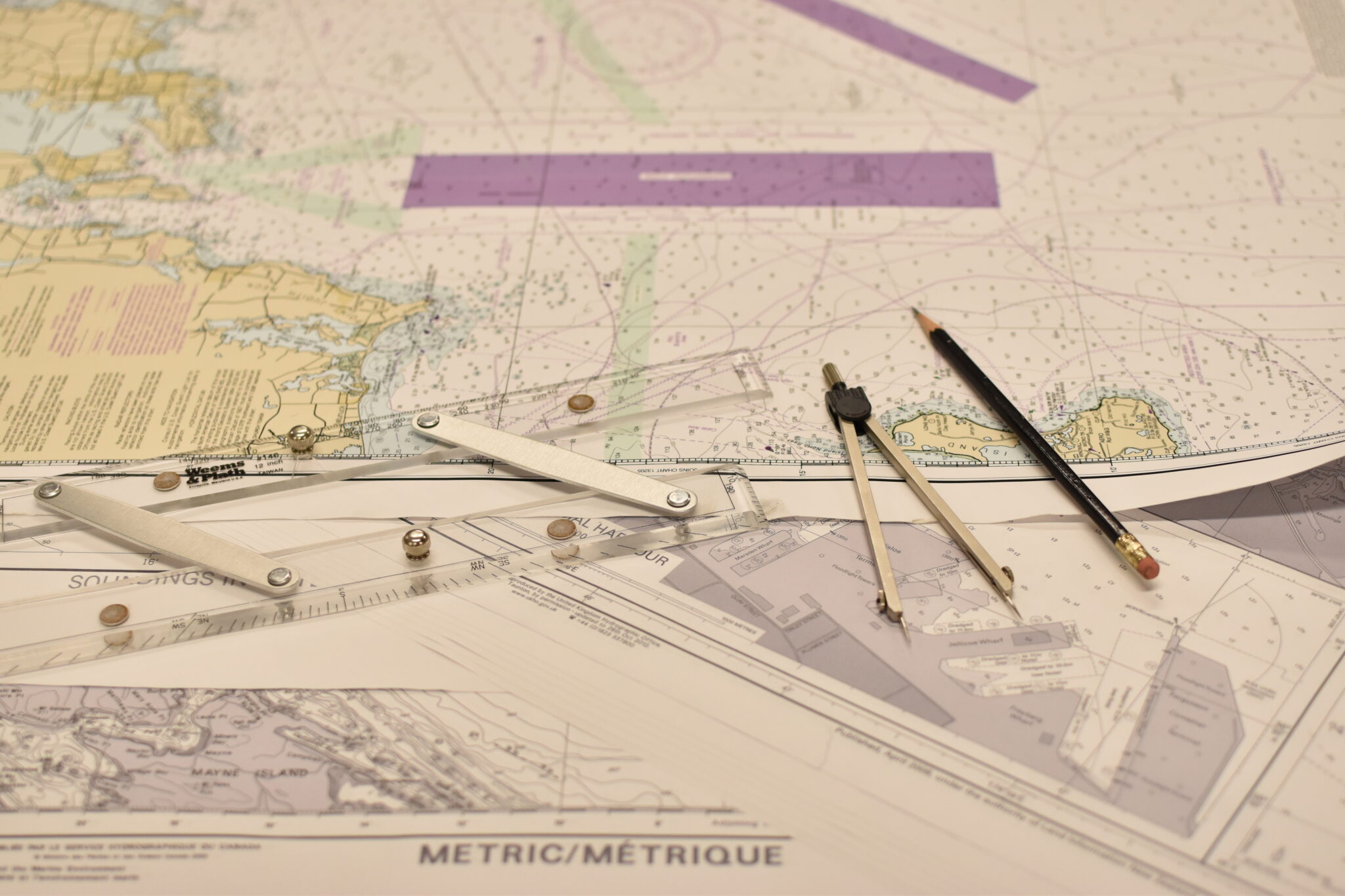
7. Landmark and Coastal Navigation – Following Familiar Features
Landmark navigation relies on recognizable features in the surrounding environment to establish direction and identify location. These features may include mountains, rivers, coastlines, buildings, towers, roads, or other distinctive objects. For thousands of years, travelers used visible geographical features to move between settlements and reach destinations.
The method required familiarity with the landscape, knowledge passed between local communities, and an ability to recognize changes in the environment. Before sophisticated instruments became common, landmarks offered practical reference points for journeys across both land and water.
Coastal navigation became particularly important for early maritime trade. Sailors followed coastlines, identified headlands, recognized islands, and used the shapes of bays to understand where they were. A vessel traveling near shore could compare the visible landscape with descriptions or sketches recorded during earlier voyages.
Navigators also paid attention to water depth, seabed characteristics, tides, and local currents. These observations helped crews approach harbors, avoid dangerous reefs, and identify suitable anchorages.
Familiarity with local conditions was particularly valuable in areas where the coastline contained narrow channels or hidden hazards.
Inland travelers relied on similar methods. Merchants followed established roads between towns, while guides used mountain passes, river valleys, and distinctive hills to direct people through unfamiliar terrain. Rural communities often maintained detailed local knowledge about seasonal routes, water sources, and safe crossings.
Travelers could also use man-made features, including bridges, churches, signal towers, and boundary markers. Such references helped people identify their surroundings and estimate how far they had progressed. A journey was often planned around recognizable stopping points rather than precise geographic coordinates.
The limitations of landmark navigation became apparent when visibility was poor, or the landscape offered few distinguishing features. Fog could hide coastal landmarks, darkness could make familiar objects difficult to identify, and forests or deserts could provide few obvious reference points.
Rivers could change course, paths could disappear, and newly constructed roads could alter established travel patterns. Travelers reduced these risks by combining visual observations with compasses, written route descriptions, maps, and estimates of travel time.
Experienced guides also relied on local environmental knowledge, including weather patterns and the characteristics of the terrain.